


1
00:00:00,000 --> 00:00:02,940
Michael Dauphinais: Following is an azpm original production.
2
00:00:09,620 --> 00:01:04,070
Christopher Conover: Welcome to The Buzz. I'm Christopher Conover, this week preparing for peak wildfire season. The term wildfire season has fallen out of fashion in Arizona at this point, fires can spark any time of year. Just this week, a fire caused evacuations near St John's in eastern Arizona, and a few weeks earlier, another fire caused evacuations in the community of pine flat southeast of Prescott, while fires are now a year round worry in the state, the season traditionally peaks in late spring and stays until the monsoon arrives. As the season approaches, firefighting teams are busy taking preventive measures. Joining me now in the studio is our producer, Zac Ziegler, who is able to see some of those preventive measures in person. Zac, welcome back to this side of the glass.
3
00:01:04,100 --> 00:01:05,270
Zac Ziegler: Hey, good to be here.
4
00:01:05,450 --> 00:01:13,280
Christopher Conover: So a couple of weeks back, you were out learning about efforts to reduce the stakes of wildfires. Tell us a bit about where you were and what you saw.
5
00:01:13,690 --> 00:02:07,330
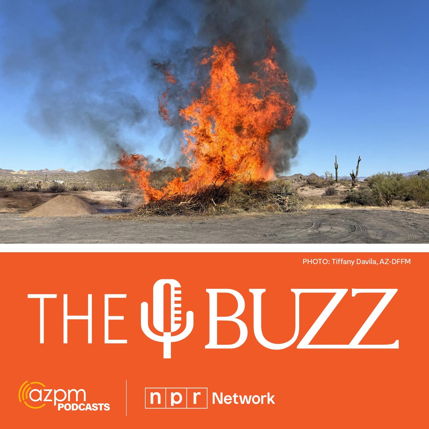
Zac Ziegler: Yeah, so I was out in Lost Dutchman State Park. It's a bit east of Phoenix in the foothills of the Superstition Mountains. It's named after that fabled gold mine that happens to be in that area, and it also happened to be the location of a spot where they used fire to clear out some down and dead vegetation. I was a tad late due to a mix up at the entrance gate, so burning was maybe 10 or 15 minutes underway when I got there, and when I walked up, what I saw was a big pile of dead plants in a clearing that had been lit on fire. The first person I met was Roy Hall, a prescribed fire officer for the state. He said this is an effort that involves the cooperation of a lot of agencies, starting with crews working at the state parks who spent months gathering a bunch of that wildfire fuel into these piles.
6
00:02:07,630 --> 00:02:21,580
Roy Hall: And we have our cooperators help us the fire departments. And we also have our crews and engines from Department of Forestry and Fire Management here.
7
00:02:22,660 --> 00:02:35,290
Zac Ziegler: Man, this thing's really starting to pick up. And the time we started talking, it's, it's getting getting pretty warm. So how much of an area did all of this fuel that you piled up here come from?
8
00:02:35,980 --> 00:03:00,370
Roy Hall: This is an estimate. And we just, we talked to the park officials and and kind of find out what their program is, and what we're looking at here this morning is probably debris from an approximately 25 acre area that was brought in here to dispose of. There are various disposal methods, but probably the most efficient and the most cost effective is always fire.
9
00:03:01,750 --> 00:03:17,200
Zac Ziegler: Give me, give me some of the basics of why it's important to clean out this material and just get rid of it now, as opposed to, you know, when nature would eventually get rid of it with a wildfire.
10
00:03:17,590 --> 00:04:04,120
Roy Hall: Well, just last year, we had a fire in this general area right here, and due to the fact that Arizona is prone to fire activity, and in June is the most detrimental time to have that happen, the last week in June is very, very condemning. So what we end up doing is we try to take opportunities to reduce that debris. And here's why, the lowest decay rate is in the desert. And in Arizona, we have a lot of desert, a lot of desert. So as we look at these heritage landscapes in Arizona that evolved with fire because of because
11
00:04:04,120 --> 00:04:06,760
Zac Ziegler: Here we'll step back. that's getting a little warm
12
00:04:07,420 --> 00:04:51,820
Roy Hall: because of lightning. The Mogollon Rim runs right through the upper third of Arizona's geographic spectrum. Runs from Ash Fork to Silver City, New Mexico, that Mogo and rim is the highest lightning activity area in the United States, second number two. It's not the highest, it's number two, second only to Florida. So our our landscapes and our heritage vegetation in Arizona, because it doesn't decompose, because we are in a dry environment, disposal of hazard fuels is absolutely essential.
13
00:04:51,880 --> 00:04:58,420
Christopher Conover: You said twice in that audio that the fire was getting hot. Tell us about what you saw and felt.
14
00:04:58,780 --> 00:05:37,300
Zac Ziegler: Yeah, so I was walking up. Like I said, it was underway, the flames were pretty tall, and it felt like a nice bonfire. By the time I was getting that interview going with Roy Hall, we were like 10 minutes in, and the flames were well north of 10 feet high. We were probably about 30 feet away, but the heat was getting so intense during the interview, I was literally looking to make sure my arm hairs weren't singing. It had that feel when you're that close to a fire, despite the fact that we were that far away. Hall told me that if I thought this was bad, it's nothing compared to what happens in an actual wildfire.
15
00:05:37,630 --> 00:06:21,130
Roy Hall: You felt the radiant heat off of this pile today and in June, because of the air temperature and the fuel temperature, we get to the century mark on our temperatures, our daily temperatures, that that heat that comes off of those fires, and our fire carrying fuels, these light fuels and grasses, is going to be exponential compared to today. A factor of 10 higher. So as much as we can do strategic location of fuel treatment and hazard fuel reduction that we can get rid of and do that in February and March and even in the fall, is not going to be problematic in June.
16
00:06:21,760 --> 00:06:26,830
Zac Ziegler: And he said, while radiant heat was what we were feeling, it's not the biggest issue.
17
00:06:27,400 --> 00:07:00,070
Roy Hall: Embers coming out of that pile can start spot fires most times. It's fairly short range, 100 yards or less. But then if the wind's blowing, it can send spot fires a quarter to a mile and a half in front of a fire. So we look at prescriptive criteria of temperature, relative humidity and wind, so that that we've got the weather factors on our side, when we do prescribed fire. When a wildfire occurs, we don't always have those conditions on our side.
18
00:07:00,460 --> 00:07:11,770
Christopher Conover: That's interesting. So they're basically taking fire and putting it in the most advantageous situation, clear land, conditions that aren't super dry yet, and plenty of crew on hand. It sounds like,
19
00:07:11,860 --> 00:07:43,060
Zac Ziegler: yeah, that's what I also heard from the next person. I talked to, another man with a voice that if he hadn't gone into fire, he could have gone into radio Bob Arthur, he's the Division Chief for the central district for the Arizona Department of Forestry and Fire Management. I noticed, before we started talking, that this area had some charred plants. It had actually burned in a wildfire in 2024 I asked him about the importance of having a managed fire like this one, versus what had happened here previously.
20
00:07:43,120 --> 00:08:11,160
Bob Arthur: If we can reduce the amount of vegetation within the park or in the forest itself, that is going to reduce the size and potential start of a wildfire within that area, and then with less vegetation, the rate of spread, or the growth of that fire is going to be reduced, therefore being a smaller fire and easier for folks to catch and suppress.
21
00:08:12,350 --> 00:08:34,010
Zac Ziegler: So I mean, in the time I've been out here, I've been rolling tape for like 20 minutes, this thing went from just getting started to raging to starting the die down process. I mean, is this typical for how long it takes one of these burns to get started, get going and start to peter itself out?
22
00:08:34,100 --> 00:08:51,290
Bob Arthur: As you're looking here a pile burn, as we call it. This is all vegetation that has been cut for approximately one year, so it's had plenty of time to dry. The way these piles are made, there's they get a lot of air flow around them, so they they do consume fairly quick. Yes,
23
00:08:51,620 --> 00:08:58,790
Christopher Conover: it's interesting that you said in there that the fire was starting to die down already. As you said, you weren't there that long.
24
00:08:59,120 --> 00:09:25,490
Zac Ziegler: No, we're getting a pretty real time look. This is maybe 15-20 minutes since I arrived, and you can hear in the background audio how that wood burning noise has died down and you're starting to hear the crew talk a little more. The tense part was over, but they were still watching intently. So I asked Bob how much preparation went into getting this big climactic event that lasted less than an hour.
25
00:09:25,660 --> 00:10:07,780
Bob Arthur: So normally, park employees themselves will come in and cut the vegetation that make these piles, and we will bring in DFFM personnel approximately one week prior to the burn to make sure the pile is constructed correctly remove any vegetation from the edges so we don't have any escape out of the pile. We also utilize the local fire district to support us with with additional personnel. All water tenders and engines to help us ensure that that pile stays where we want that pile to stay.
26
00:10:08,080 --> 00:10:19,150
Zac Ziegler: What are the things that you hope the public knows about these kind of of interactions? What do we, the folks who aren't doing this stuff, need to know to make you all's lives a little easier?
27
00:10:19,420 --> 00:10:46,120
Bob Arthur: You know, if everybody can do a little fire wise or some some yard work around their homes and private property, that's going to make our jobs easier. If there's less fuel, whether it be, you know, still growing dead and down vegetation on on the ground, if we can go in and clear that, that is going to make our jobs much easier to protect their homes and their private property going forward.
28
00:10:46,570 --> 00:11:00,340
Christopher Conover: that idea of clearing out dead and downed vegetation, not just from public lands, but also private, is something that sounds pretty important for people who live near natural areas, that wild land, urban interface we so often hear about,
29
00:11:02,730 --> 00:11:40,200
Zac Ziegler: yeah, the WUI, as it is often called, interaction between government agencies and people living near public land is something that gets talked about a lot in areas like this. And it's not just interactions like we just heard about that are the concern. There are plenty of homes not far from where I was in Lost Dutchman. I'm sure those people could see the smoke from this pile burn from their houses if they're sitting out on a back porch. So I talked with the Department of Forestry and Fire Management's Public Affairs Officer Tiffany Davilla about how they make sure that people know what they're doing and don't have to worry about that smoke when they see it.
30
00:11:40,530 --> 00:12:48,630
Tiffany Davilla: That's a great question. So we want to make sure that the public is informed well ahead of the burn. Unfortunately, sometimes with unfavorable weather or lack of resources, we have to cancel or we have to start things within 24 hours, because we have a short burn window. So at the end of the day, we try and at least give the public 48 hours, 24 hours notification that we're going to burn, because there are a lot of people with smoke sensitivity, so we want to make sure that we are informing them in a timely manner. But we write up press releases, we send those out to the media, we post on our social media channels, and then we also post to Nextdoor, depending on where the burn is taking place. That way, we can really target that area. We also have an app that we use to send out push notifications for ignitions as well. So we really start crafting our messaging well ahead of the prescribed fire. But again, because we only have such a short window of time to get these done, sometimes it's not as much notice that I would like to give to the public, but unfortunately, they have to get these projects done before we move into our critical burn period, which is our fire season, because at that point, with the conditions, we have to stop these burns, and our resources are now allocated to fires.
31
00:12:49,320 --> 00:12:59,970
Zac Ziegler: And I'm I'm guessing, like you were saying with sometimes that happens quick, sometimes it gets delayed. You know, that's it's all a function of of weather, and you'd rather do it right than do it on a schedule.
32
00:13:00,170 --> 00:13:36,680
Tiffany Davilla: Well, we'd rather do it right and do it right safely, because if we burn when there's wind gusts or unfavorable relative humidity levels, we could possibly lose that burn and that's the last thing we want to happen. We're doing these to clean up our areas, to remove the debris piles that were left over from fuels mitigation work, clean up our forests, improve the health of our forests, and so we want to make sure that we're crossing our T's, dotting our i's, before we do that first ignition. With that these projects can be planned well in advance, and I'm talking years in advance.
33
00:13:37,040 --> 00:13:50,240
Zac Ziegler: How routinely are these things happening across Arizona? It's a big state. There's plenty of fire danger around here. How frequently do we see piles like this and crews like this gathering to do the work?
34
00:13:50,420 --> 00:14:21,980
Tiffany Davilla: So we usually burn in the fall, the winter, and then in the early spring, before again, our fire season kicks off, and that's when we have the resource availability. That's when we have the better weather conditions. We're burning today in Flagstaff after the recent snow that they received over the last couple of days. So we're doing a pile burn up there as well. This is a pile burn. We'll do a broadcast burn. We did that a couple weeks ago out at the Arlington Reservoir west of Buckeye. So now is the time for us and our federal partners to get out there and do their project work. Because of the weather conditions and the resource availability.
35
00:14:22,220 --> 00:14:35,060
Christopher Conover: always worth checking on that smoke if you live near a wildland area. Zac, thanks for taking a day trip to one of our scenic state parks and bringing us back this look into how prescribed fire works in Arizona.
36
00:14:35,210 --> 00:14:38,240
Zac Ziegler: I'm always down anytime you want to send me to a beautiful place.
37
00:14:39,830 --> 00:14:48,530
Christopher Conover: You're listening to The Buzz after the break, we hear about the role of wildfire historically in the US and Canada. Stay with us.
38
00:14:49,310 --> 00:15:04,010
NPR promo: We could all use a little help navigating the news these days. The consider this podcast wants to give you a hand six days a week, we'll help you make sense of the day's biggest news story and what it means for you in less than 15. Minutes. Listen now to the consider this podcast from NPR.
39
00:15:04,490 --> 00:15:48,920
Christopher Conover: Welcome back to The Buzz. I'm Christopher Conover. We're looking at efforts to prevent massive wildfire damage. This week, we heard about an overabundance of vegetation that can easily burn when fire reaches it in the first half of our show. So why do we have such a major backlog of burnable material on the ground? A recent study co authored by University of Arizona Fire Ecologist Dr Don Falk aimed to explain that. Falk and the team looked at fire scars in the tree ring data and found that wildfire used to be much more frequent between the years of 1600 until about 1880. I started by asking Falk about that revelation.
40
00:15:49,320 --> 00:16:26,820
Don Falk: We compared contemporary records of fire occurrence for the last 40 years with a historical record over many, many centuries. And we see this through tree rings, such as are done at the tree ring laboratory here at UA. It turns out, when trees are exposed to fire that doesn't kill the tree, their tissues actually record a scar that ends up in the wood inside the tree. And because we can date the tree rings, that is, we can assign a calendar year to each ring in a tree, we can date the fires, and we've now done this at over 2,000 fire sites across North America based on 10s of 1000s of trees.
41
00:16:27,030 --> 00:16:34,470
Christopher Conover: So what did fires look like back in those years that your study mentioned, versus today's fires?
42
00:16:34,660 --> 00:17:45,790
Don Falk: What the fire scar data showed us is that widespread fire years were much more common historically than they are now. And when I say historically, I mean prior to 1900 which is when fire regimes in the western US start changing. And so these fires were occurring at multiple sites all over the landscape, burning probably all summer, maybe until weather cooled off in the fall, or even until the winter rains. But they weren't the high severity, spectacular, catastrophic fires that we see in the news today. They were low severity ground fires, maybe flame lengths up to your knee or to your waist. Animals would just run away or burrow into the ground until the fire passed. These were covering very large areas as a consequence. And so it's a kind of fire that we don't even have now. The only fires in wildland areas that we see today are the ones burning at extreme weather conditions and fuel conditions, which means we can't put them out. That's a fraction of the fires that occurred historically. Most of the historic fires were these low severity, benign fires that actually helped to stabilize our forests.
43
00:17:46,030 --> 00:17:55,510
Christopher Conover: The obvious question right there is, what happened to make the fires become more severe, though less often?
44
00:17:55,870 --> 00:19:12,100
Don Falk: We know a lot about these historic fires, and I should be clear by the way that I'm describing the fire regime that occurred over most of the western and central United States. There are certainly areas that burn naturally at very high severity up in the Pacific Northwest, along the coast range and the Olympic Peninsula, parts of the Boreal Forest in Canada, those typically had more high severity stand replacing fires, although those have changed also. Well, if you're having fires occurring in any given area, let's say every 10 to 20 years, in some areas, more frequently than that, what happens when you exclude fire from the landscape, which is pretty much what we've done for the last 120 years. What happens is that the fuels that would have been consumed in these spreading fires remain there, unburned, and they start to accumulate. So we now literally have 120 years of fuel accumulation in many of our forests. And as a result, when a fire does occur, you get these spectacular, catastrophic fire events. So in a very real sense, the very severe, catastrophic fires we're seeing are an unintended consequence of our own actions, and it's very much to our detriment, as we're realizing.
45
00:19:12,300 --> 00:19:30,240
Christopher Conover: So I guess the next obvious question is, okay, we have 120 years of build up. We hear about prescribed burns, which I'm sure helps get rid of some of that. Have we just put ourselves in a corner, though, that really we can't get out of at this point? Or is there something that can be done?
46
00:19:30,480 --> 00:23:14,970
Don Falk: We have painted ourselves into a corner pretty badly on our public lands and our open forest. There is a lot of prescribed burning being done by our land managing agencies across the West, and maybe more than people realize. In fact, some years there is more area being burned in a prescribed fire than in wildland fire. So there is a lot of effort to reduce fuels, and there is also a lot of effort in using mechanical means to using large chipping machines or chainsaws to reduce fuels. When we say fuels, by the way, we're talking about vegetation, shrubs and especially small trees. So if we look at the density of trees, that is how many trees that were per acre, historically, it's on the order of maybe 50 to 60 trees. And today we have sites that have over 5000 trees per acre, and these are almost all small trees that grew in after we started keeping fire off of the landscape. Well, those trees are highly flammable. They carry fire up into the canopy, and then they catch the entire forest, including the old trees, on fire. So we have the fire behavior that is driven by having so many trees on the landscape. Thinning those forests out mechanically is very effective at modifying fire behavior. But whether it's a prescribed fire or mechanical treatment, it's not one and done. You don't just do it and then walk away. Those treatments last for about, let's say, 20 years. And the reason for that is that after a fire or after thinning, guess what, nature grows back and the area starts to re vegetate. That's a good thing. That's ecological resilience, which is absolutely essential, but it does mean that once you've done a thinning project or a prescribprescribed burn you have to come back on something like that natural interval, that 10 to 20 year interval. Well, that is a lot of work, and the cheapest way to do this would be to let fire do the work itself. And in fact, there are a few areas in the United States where this is being done, and we see how, not only how beneficial, but how cost effective it is. We have a salient example of how we can keep fire in the ecosystem in a way that is sustainable right here in the southwest, in the Gila Wilderness in western New Mexico. In the Gila, for the last 50 years, land managers have allowed fire to stay in the system, and to be part of how that system works, this includes both ignitions from lightning, but also prescribed fires that they introduce. And the result is that when a large fire occurs, we don't get the kind of catastrophic burning down of the house that we've seen in recent fires in Los Angeles and Hawaii and so many other places. For example, in 2011 the same year when we had the gigantic Las Conches Fire in New Mexico, which was the largest fire in the state. Up until that time, there was a 90,000 acre fire burning in the Gila, but nobody knew about it, because it was not making news. It was just doing what fire does, which is creeping over the landscape for weeks and weeks at a time, thinning out fuels, but not causing any real damage. So that proves that it is actually possible to get ourselves out of this box. And incidentally, in 2021, another fire burned in that same area, the Johnson fire, the same thing over 90,000 acres. Nobody hears about these fires because they're not the same kind of news that people are accustomed to. But it's important that we recognize that these show us a way to get out of the box that we painted ourselves into.
47
00:23:15,240 --> 00:23:31,980
Christopher Conover: So this research is all through the University of Arizona's Tree Ring Lab, but you've got federal partners in this too, I would assume, because there is so much work that's being done US Forest Service and things like that.
48
00:23:32,190 --> 00:24:16,920
Don Falk: Yes, this work represents the cumulative effort of hundreds of scientists over several decades. That's what took to create this archive of fire history that goes back many centuries and extends all the way from Alaska down to southern Mexico. And these scientists are both University scientists and federal scientists, and I have to say it's tragic that at the very moment we need to understand how climate and line management are driving us toward more destructive wildfires, federal scientists are under a severe threat and facing a very uncertain future. I think as citizens, we should all be very, very concerned that federal scientists are being undermined and will be unable to continue this kind of essential work.
49
00:24:17,250 --> 00:24:30,840
Christopher Conover: We've had a dry winter here in Arizona. The preceding summer was pretty dry. You're a Fire Ecologist. What does fire season look like for Arizona this year?
50
00:24:31,290 --> 00:27:03,210
Don Falk: It's always a bit risky to try to look in your crystal ball and predict the coming fire season, but a dry winter and variable monsoon over the last few years, and the possibility of warmer temperatures coming a little earlier than they do. That suggests that fire season may be starting earlier, and we do see a trend of early fire seasons. In fact, we're starting to see red flag warnings in the southwest already. At this time of year, we would not have. Historically seen red flag warnings until several weeks later. So there are a lot of signs that we could be in for a big fire season, but your question underlines a very important point, and that is the role of climate in modulating fire regimes, and especially the kinds of findings that we had. I mentioned the role of keeping fire out of the landscape, in allowing the accumulation of fuels, and that really is the driver of fire severity, that is the fire behavior and the effect it has. But how large an area over the United States burns that's really driven by climate. And when we say climate here, we mean specifically temperature. The reason for this is that higher temperatures dry out fuels. They create an atmospheric demand of the moisture in the vegetation and the soil. So the warm air pulls moisture out of plants and out of the soil, and it dries everything out. So in fact, records of temperature over the last 50 years, compared to records of the area burned in North America show a very strong relationship. As temperatures go up, the area burned goes up. And the unsettling thing is that it goes up actually exponentially. So with an increase in the aridity and temperature in our ecosystems, we actually see the area burned increasing at a more rapid rate. We don't know where this is going to lead, but there's no question that climate variability and a particular climate change is contributing to these catastrophic fires. This means that the two big drivers of these large destructive fire years, climate change and fuel accumulation by excluding fires are really on us. Unfortunately, we have created the conditions in which fires like this are inevitable. Our hope is that this will encourage the public and policy makers to take more seriously the essential need of bending the climate change curve, because otherwise we're headed for a train wreck.
51
00:27:03,360 --> 00:27:12,360
Christopher Conover: That was Don Falk, Professor in the School of Natural Resources and the Environment at the University of Arizona, and that's The Buzz for this week.
52
00:27:21,420 --> 00:27:41,740
You can find all our episodes online@azpm.org and subscribe to our show. Wherever you get your podcast, just search for the buzz Arizona. We're also on the NPR app. Zac Ziegler is our producer, with production help from Maggie farmer, Our music is by enter the haggis. I'm Christopher Conover. Thanks for listening.
53
00:27:50,510 --> 00:27:59,510
Nicole Cox: Like this podcast, your support makes AZPM original productions like this one possible Donate at azpm.org/give
